

Flow Models
Flow models are used to predict the current that brings a supply of oxygen to the fish and transports waste from the site. Both 2 and 3 dimensional open ocean flow models have been integrated into AquaModel.
The process involved in developing these models includes: collecting measurements in the area of the study, developing a mesh of measurements with associated readings, validating the predictave capability of model, and finally inputting the model output into AquaModel for use in conjunction with site-specific data and fish characteristics to simulate farm operations and their effect on the environment and on fish growth.
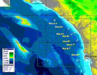 The Southern California Bight Test Site
For the study of this site, the Jet Propulsion Laboritory's 3 dimensional ROMS model was used. JPL also provided the measurement data of ocean and weather conditions to populate the mesh used by the model. More information on this model can be found at the JPL Our Ocean Portal website.
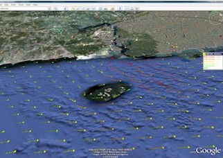 UNH Open Ocean Aquaculture Site
The New Hampshire site, located in shallow water uses the 2-D ADCIRC Model. Dr. Fredriksson gathered the measurements and produced the mesh of ocean conditions in the site area. Dr. Irish validated the model by gathering actual measurements and comparing them to those predicted by the model. Click here to view a thorough description of the model used.